161 Emley's Hill Road, (Imlaystown) Upper Freehold, NJ 08526 - Trail Head Parking
202 Davis Station Road, (Imlaystown) Upper Freehold, NJ 08514 - Activity Center
609-259-5794 - Ranger Station
Park Brochure & Map | Tick Advisory
Park opens at 7 a.m. daily, year round.
Closing time is 8:30 p.m. through April 28; 9 p.m. April 29-May 26; and 9:30 p.m. May 27-July 21.
The parking area on Emley’s Hill Road will be closed intermittently during the week of April 15 due to road paving. Please use the parking area on Davis Station Road. (updated 4/15/2024)

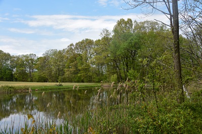
You'll feel many miles away from civilization as this rustic 450-acre site in rural Upper Freehold is located amidst the rolling farmland of western Monmouth County. One of the most beautiful parks in the Park System, the property is known for stately stands of red and white oak, beech, ash and birch trees.
Located along the Upper Freehold Historic Farmland Scenic Byway, a 24-mile stretch that captures the agricultural, historical, environmental and cultural traditions still visible around Upper Freehold and Allentown, Clayton Park offers miles trails for visitors to explore.
In late 2015, the Park System acquired the Imlaystown School on Davis Station Road. Once home to the offices of the Drug Abuse Resistance Education New Jersey, the building is now called the Clayton Park Activity Center and allows the Park System to offer a variety of programs in the park.
In accordance with New Jersey’s Smoke Free Air Act, all Monmouth County parks are tobacco free. The ban applies to cigarettes, pipes, cigars, e-cigarettes, and vaporize cigarettes, as well as smokeless tobacco such as snuff and chew.
Trails
The forested, hilly trails of this park have become a popular destination for hikers, equestrians, and bicyclists. Enter from Emley's Hill Road (6 miles of trails).


Map to Activity Center
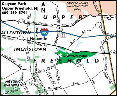
Locator Map

Directions to Trail Head
- Interstate 195 to exit 11 (Imlaystown/Cox's Corner). Eastbound, turn right and follow to end; westbound, turn left and follow to end. Turn left onto Rt. 526 and make immediate right onto Imlaystown-Davis Station Rd. Follow to Emley's Hill Rd., turn left. Follow to Park on left.
- Rt. 537 west to Rt. 526 (becomes Red Valley Rd.) to Imlaystown-Davis Station Rd. Turn left and follow Imlaystown-Davis Station Rd. to Emley's Hill Rd., turn left and follow to Park on left.
Directions to Activity Center
- 1-195 W to Exit 11 turning south toward Imlaystown. Keep left at the fork, follow signs for Imlaystown. In 300 feet, turn left onto Imlaystown-Hightstown Road. In .8 mile turn left onto Allentown-Lakewood Road. In 150 ft., turn right onto Imlaystown Road. In .1 mile, slight right onto Davis Station Road. Activity Center is in .2 mile on the right.